
Lake Charles ZIP Coverage
The working postal-city list contains eleven Lake Charles codes, but it should be checked against the live postal tool for each address. Some are standard delivery areas, several are associated with post office boxes, and others appear as unique or special designations. The named retail station is a useful clue, not a boundary map and not proof that all mail in that code passes across its public counter.
| ZIP | Area or type lead | Post office found | Search note |
|---|---|---|---|
| 70601 | Central Lake Charles, standard | Lake Charles, 921 Moss Street | Verify each street through USPS |
| 70602 | Lake Charles PO Box designation | No separate facility preserved | Not proof of a physical site |
| 70605 | Drew and south Lake Charles lead | Drew, 5000 Lake Street | Station clue, not a mapped edge |
| 70606 | Lake Charles PO Box designation | No separate facility preserved | Check the exact delivery address |
| 70607 | Standard Lake Charles area lead | No station result preserved | Compare USPS and GIS |
| 70609 | Unique or institutional lead | No retail facility preserved | Institutional association needs verification |
| 70611 | Moss Bluff and Lake Charles postal area | Moss Bluff, 172 East Telephone Road | Check city limits in GIS |
| 70612 | Lake Charles PO Box designation | No separate facility preserved | Mail and physical address can differ |
| 70615 | Eastside and southeast postal area | Eastside, 950 Main Street | Verify the exact street |
| 70616 | Lake Charles PO Box designation | No separate facility preserved | Does not establish city residence |
| 70629 | Unique or special designation lead | No separate facility preserved | Exact assignment needs an address check |
The live USPS ZIP Code Lookup remains the authority for delivery normalization. Use its By Address path for one location and its By City and State path for a current list. The postal result does not confirm that a person or business occupies the address.
Lake Charles ZIP Stations
Four official station pages were captured for the Lake Charles ZIP code directory research. The main Lake Charles Post Office serves as the clearest central reference. Drew points to the south side, Eastside supplies an east Lake Charles reference, and Moss Bluff highlights the postal-name problem beyond the municipal core.
The official Lake Charles Post Office page is shown below.
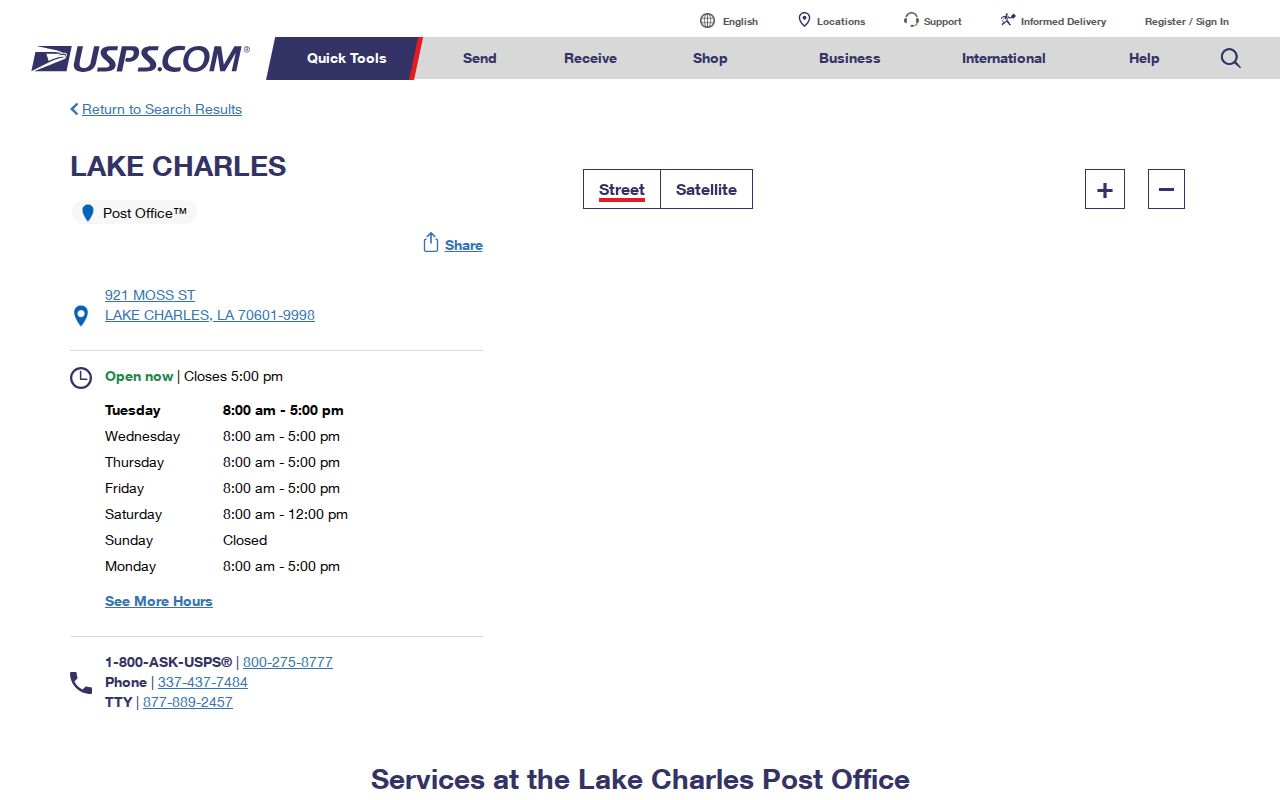
A facility address identifies a retail site, not the outer limit of its service. Route assignments can change, and a delivery point can use Lake Charles as the postal city while falling in an unincorporated area.
The Drew Post Office details provide a second official station reference.
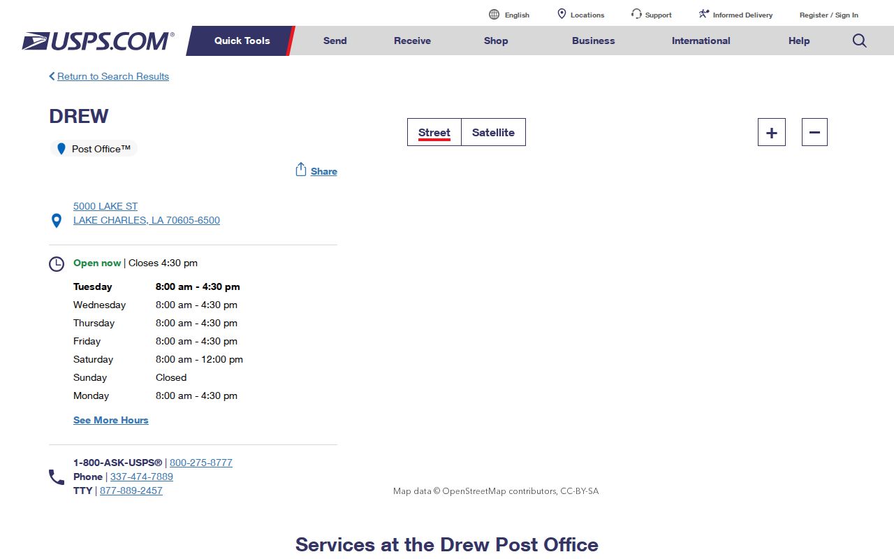
Use the street and ZIP shown by the live address result when a directory record and a station name do not seem to match.
Find Lake Charles Residents by ZIP
A ZIP code can narrow a search, but official tools treat it in different ways. The Louisiana Voter Portal requires a five-digit ZIP in both its voter-name and address searches. The assessor search does not expose a ZIP filter in the inspected form. It accepts owner, property address, parcel, subdivision, and legal-description routes instead. The Clerk's Home Sales tool uses city and address controls, not ZIP.
- Normalize the full address with USPS. Keep the returned street spelling, city, state, and ZIP.
- Plot the point in Calcasieu GIS. Turn on City Limits and Towns so the postal city is not mistaken for the municipality.
- Check the Calcasieu Parish Assessor by physical address or parcel. Do not look for a ZIP-wide owner list in a form that has no ZIP filter.
- Use the Louisiana Voter Portal only for its permitted public lookup. Registration records do not cover every Lake Charles resident.
- When the work narrows to one road, continue with the Lake Charles street and address directory.
Keep each source label. A USPS result proves a postal assignment; GIS places the address on a map; the assessor identifies a parcel and assessed owner; the voter tool reports a limited registration result. Combining them does not turn any one source into proof of current occupancy.
Lake Charles ZIP Search Fields
The Louisiana Voter Portal has separate routes for a name and an address. ZIP is required in both. This makes it useful for resolving a Lake Charles postal area, but the result is limited to registered voters and protected fields remain restricted under Louisiana law.
| Portal route | Fields used | ZIP rule | What it can show |
|---|---|---|---|
| Voter name search | First name, last name, birth month, birth year | Five-digit ZIP required | A matching current registration result |
| Voter address search | Street address, city, optional apartment or lot | Five-digit ZIP required | Voters displayed at an address, subject to limits |
| USPS By Address | Company optional, street, city, state | Returned by the tool | Normalized delivery ZIP and city |
| USPS By City and State | City and state | Result list | Current postal codes associated with the city name |
Louisiana R.S. 18:154 generally permits inspection and copying of voter records while restricting sensitive data, commercial circulation, and protected-voter information. The Address Confidentiality Program can substitute an address for eligible survivors. Never treat no result as proof that a person is absent from Lake Charles.
Lake Charles ZIPs and City Limits
Postal geography and city government answer different questions. ZIP codes route mail. Lake Charles city limits define municipal jurisdiction. Calcasieu Parish contains incorporated cities and unincorporated communities, and a mailing label can use Lake Charles for places associated with Moss Bluff, Prien, Carlyss, Westlake, Sulphur, or another parish area.
The mismatch matters whenever the office depends on jurisdiction. A City of Lake Charles permit or public-record request follows the city boundary, not the words on a mail label. Parish assessment, deed, and GIS records cover the wider Calcasieu jurisdiction. Use the GIS City Limits and Towns layers before choosing a custodian.
The official Moss Bluff Post Office page makes the distinction visible.
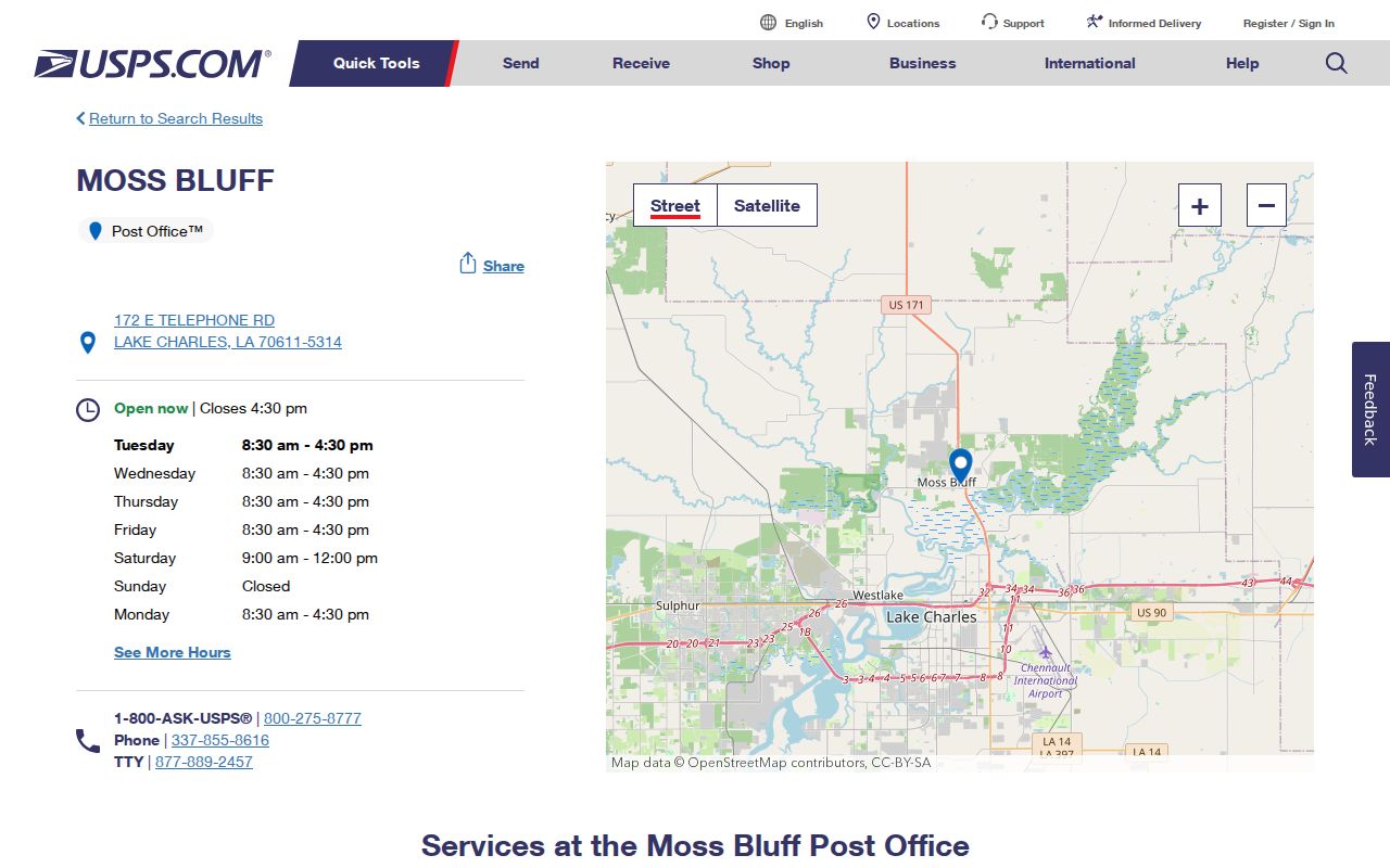
For a 70611 address, confirm the delivery label with USPS and the municipal status with GIS. Neither clue should be inferred from the other.
- ZIP and ZIP+4
- The five-digit code covers a delivery area. Four added digits narrow mail routing to a smaller segment or delivery point.
- PO Box ZIP
- A code associated mainly with boxes. It may describe where mail is collected, not the physical site tied to a record.
- Unique ZIP
- A code assigned for a high-volume organization or special delivery pattern. It is not a neighborhood boundary.
- Carrier route
- A postal delivery sequence within a ZIP. It can change and is not the same as a census or city district.
Lake Charles ZIPs Versus ZCTAs
Census maps often show ZIP Code Tabulation Areas, called ZCTAs. The Census Bureau explains ZCTAs as generalized polygons built from residential address data. They approximate broad ZIP patterns for statistics. They are not USPS delivery codes.
A ZCTA may cross a city line, omit a code with no home delivery, or handle PO Box and unique codes differently. It is useful for comparing broad population or map patterns. It cannot validate a Lake Charles mailing address or establish that a named person lives within its polygon.
The captured Census guidance below provides the official distinction.
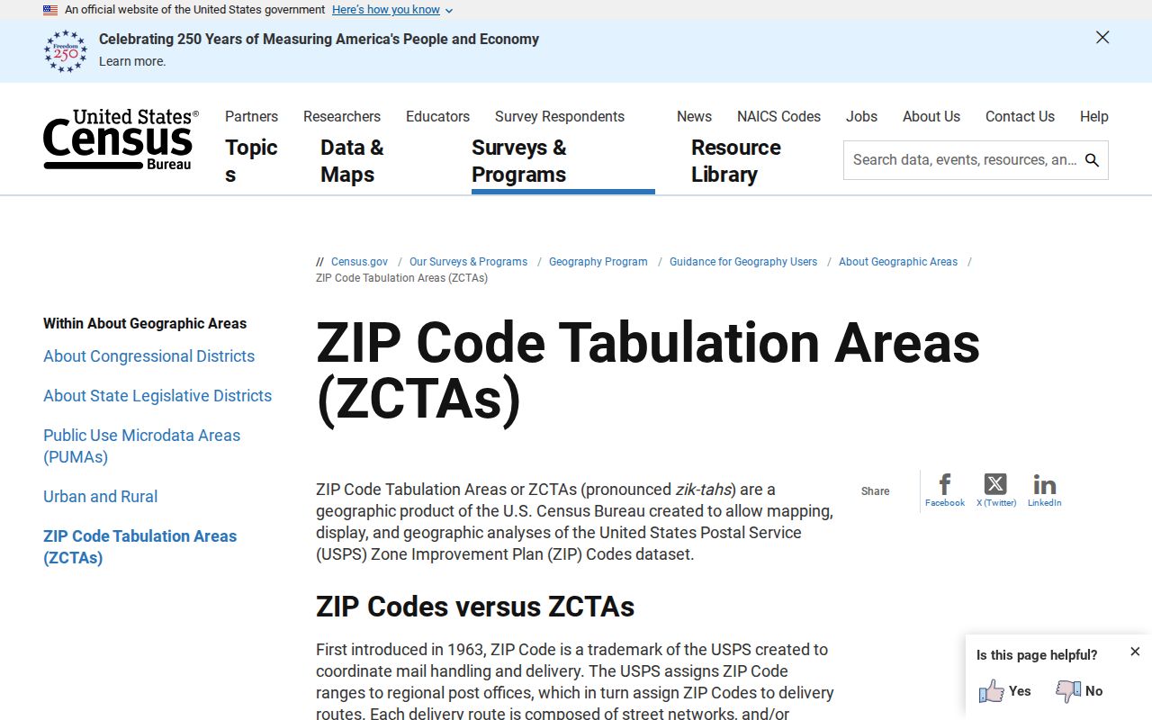
Label a map as ZCTA, ZIP, city limit, town, ward, or district. That one word prevents a statistical area from being cited as a postal fact.
Match a Lake Charles ZIP to Parcels
The Calcasieu Parish Assessor search does not offer a ZIP box in the inspected interface. Search a physical address, owner, parcel number, subdivision, or legal description instead. The result can separate mailing and physical fields, which is crucial when a tax notice goes to a different ZIP than the property.
Calcasieu GIS maintains 911 addresses and supplies street, address, parcel, subdivision, city-limit, ward, drainage, and other layers. Call 337-721-4140 or email gis@calcasieu.gov when a point is missing or misplaced. For a legal boundary, use the recorded conveyance and plat. GIS geometry locates a parcel but is not a survey.
Note: An assessed owner, mailing contact, and physical address are separate fields; none alone proves who is present at the parcel now.
Eastside Lake Charles Postal Clues
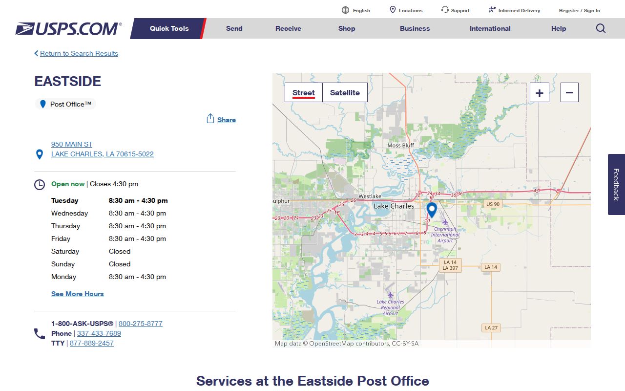
The Eastside station at 950 Main Street supplies an official facility reference for the 70615 area. It can help resolve which postal station name appears in a record, but it should not be used to draw a neighborhood edge or decide whether an address falls within Lake Charles government limits.
The USPS Eastside Post Office page is captured below.
When an older directory, deed, or public request uses a place name instead of a ZIP, keep that historical label. Add the modern postal code only after a current USPS address check.
Grade Lake Charles Address Evidence
A clean ZIP code directory search records what each source actually establishes. USPS has the best evidence for current delivery spelling. GIS has the best map point and municipal layer. The assessor ties a physical site to a parcel and assessed owner. The Clerk ties names to recorded instruments. Voter results provide limited registration evidence, while historical directories show a person or institution at a printed address in one edition.
| Delivery confidence | USPS-validated address and postal code |
|---|---|
| Map confidence | GIS geocoded point with City Limits or Towns layer checked |
| Parcel confidence | Assessor physical address and parcel identifier for a stated tax year |
| Legal confidence | Clerk instrument and legal description tied to the parcel |
| Resident lead | Voter or historical directory result, with source date and access limits |
If the sources disagree, do not force them into one answer. Save the date and label from each system, then contact USPS, Calcasieu GIS, the Registrar, Assessor, or Clerk based on the exact issue. A precise discrepancy is much easier for an office to resolve than a broad request for everyone in a ZIP.